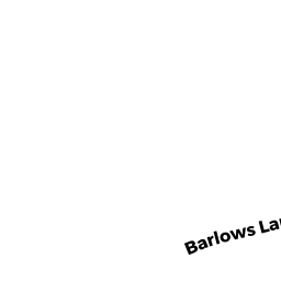
315 BARLOWS LANDING RD
Owner Information
TOWN OF BOURNE
24 PERRY AVE
BUZZARDS BAY, MA 02532


Property Details
315 BARLOWS LANDING RD is classified as a Improved, Municipal Public Safety (Fire/po station).
The primary structure on this property was built in 1947. There are 3,596ft2 of built area within this property. There is 3,596ft2 of residential/living space within this property.
315 BARLOWS LANDING RD is valued at $1,160,500. The land is valued at $933,500 and the structures are valued at $189,300. There is an additional valuation of $37,700 on this property.
This property is in Zone 1. Confirm with local Zoning Board authorities to ensure there are no overlays or other easements on this property.
The most recent deed for 315 BARLOWS LANDING RD is recorded at the local registrar in Book 140, Page 28. 315 BARLOWS LANDING RD was last sold on Tuesday, September 9, 1879 for $0.
Assessment data from fiscal year 2020.
Flood Data
This property is partially within the AE Zone (within floodplain). Approximately 0.84 acres (21.84%) of the property is within this zone.
The base flood elevation for this flood zone is 15 feet.
This information is sourced from the FEMA National Flood Hazard Layer. See our full disclamer.
Broadband Internet Providers
| Provider | Type | Bandwidth (mbps) | |
|---|---|---|---|
| PAETEC Communications, Inc | DSL | 0 | 0 |
| Viasat Inc | Satellite | 35 | 3 |
| Verizon New England Inc. | DSL | 10 | 1 |
| Comcast | Cable | 1000 | 35 |
| PAETEC Communications, Inc | Fiber | 0 | 0 |
| T-Mobile | Fixed Wireless | 25 | 3 |
| GCI Communication Corp. | Satellite | 0 | 0 |
| HughesNet | Satellite | 25 | 3 |
| VSAT Systems, LLC. | Satellite | 2 | 1 |
Broadband service provider data from December 2020.
Adjacent Properties
- 0 OLD MONUMENT NECK RD
Mass. Highway Dept. (MHD) (non-reimbursable) owned by COMMONWEALTH OF MASSACHUSETTS - 24 CLUBHOUSE DR
Mixed Use (Primarily Commercial, some Recreation) owned by POCASSET GOLF CLUB - 291 BARLOWS LANDING RD
Multiple Houses on one parcel owned by JOHNSON G HERBERT JR & NANCY C - 303 BARLOWS LANDING RD
Small Retail and Services stores (under 10,000 sq. ft.) owned by SAPP REALTY HOLDINGS LLC - 317 BARLOWS LANDING RD
Other Storage, Warehouse, and Distribution facilities (see also usecode 401) owned by KOLESHIS PRISCILLA A &